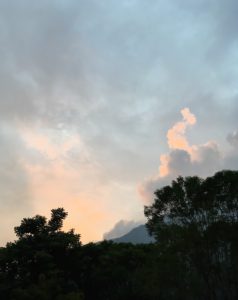
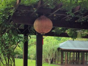
 Late August, traveling with my family. . .
Robert usually booked a weekend trip to Yilan (宜蘭), about an hour southeast of Taipei, during my summer visit. This year, he arranged for us to go south to the central region. Our first stop was near Guguan (谷關). Known for its natural hot spring, Guguan is also the entry point of the Central Cross-Island Highway (Provincial Route 8, 台8線). For my family, it marked the beginning of a cross-island trip that we took together almost half a century ago.
The island of Taiwan shapes like a sweet potato, elongated north-south. Satellite images show a narrow strip of flat land along the west coast. Mountain ranges, parallel to the east coast, make up two thirds of the island. This geographic layout poses obstacles to cross-island traffic.
The construction of Central Cross-Island Highway, beginning in 1956, was to create a commercial conduit while providing veterans with employment opportunities, both during the construction period and afterwards cultivating fruits and specialty foods. It also boosted tourism at various scenic areas—especially on the eastern end, where striking views of gorges and waterfalls attracted visitors worldwide.
I learned the significance of the highway construction at school and saw many gorgeous photos of the sceneries. Having a chance to travel across the highway was an exciting news. Still, I took the news with a little trepidation: Suffering often from motion sickness, long car rides on narrow mountain roads worried me.
We rode express train to Taichung and then, traveled from there by bus to Guguan, our first stop. Other then the hot spring, the village seemed to me, a little city slicker, a quiet rural place. It didn’t impress me much.
We headed to Lishan (Pear Mountain) the next day. The road narrowed; tracing the bank of Dajia River (大甲溪). I dozed off after taking some medicine for motion sickness. Every time I opened my eyes, I saw us sandwiched by mountains, with the river bed on one side. And, there were more curves in front of us.
As we got near, a palace-like structure appeared on the hill. Lishan Guesthouse (梨山賓館) was only a few years old at the time. A section of the establishment served as summer retreats for President Chiang Kai-shek and his entourage. The hotel was open to general public all-year-round.
It was almost surreal, after traveling on rugged roads for hours, to see a stone paved open space. Two stone-carved lions guarded a wide staircase leading up to the main entrances of the palace. The bright color of the tiled roof contrasting sharply to the mountainy green. The fancy architectural details were signs of labor and craftmanship. It reminded me of the Grand Hotel in Taipei. (As it turned out, they were designed by the same architect.)
We stayed at a more modest hotel nearby but had dinner at the Guesthouse. It was true that the locally produced ingredients were better than what we could get in the city. Even cabbages tasted amazing. Although Lishan became known for its productions of pears, peaches, apples, vegetables, and tea, much of the organized cultivation took place alongside the highway constructions. I have no recollections of whether we enjoyed any specialty fruits.
The mountain air was refreshing. The scenery serene. We were all glad to have a chance to stretch our legs, walking casually around town. Little Cop even took out his butterfly net, chasing insects. Someone helped taking a photo of us, standing in front of the Guesthouse. We were all genuinely happy. Little Cop holding his net was especially proud. The enlarged photo was framed and hung in our living room for years. It is now our most treasured memento.
Continuing our trip eastwards and upwards, we passed the highest point of the highway. As we descend, there were more and more sharp turns, as if someone took a stretch of road and folded it into sections. After a night at Tianxiang (天祥), we finally reached the most scenic part of the journey.
Mountains along Taroko Gorge began as sediment on the bottom of the ocean hundreds of million years ago. Layers of sediments, with increasing pressure, formed limestone, which in turn metamorphosed into marble. Liwu River (立霧溪) cut a narrow and steep valley through the mountain range. The stunning view of the mountains, the pristine stream of the river, and the mesmerizing shapes and colors of marble are all unique this region. As a child, I felt very small standing on the bottom of the valley. The river that supposedly had the power to erode the mountains seemed very quiet. Its water, the color of jade.
We made brief stops at several well-known spots: Swallow Grotto (燕子口), where, at one time, swallows found shelter among the rocks; Changchun [Eternal Spring] Shrine (長春祠), honoring all that sacrificed during the construction of the highway; and the East Entrance Arch Gate.
Our final stop of the trip was the city of Hualien (花蓮). After having been in and around mountains for several days, it was quite a shock to be back in the midst of city traffic. We visited the “Cultural Village” of A Mei tribe and watched an indigenous dance show. Dad always loved interesting rocks. He couldn’t be happier being in the production region of jade and marble. We added to our luggage a marble lamp base and two sizable natural rock displays—the creamy marble piece had beautiful Chinese-painting-like veins and the slightly polished jade piece shaped like a mountain.
Having crossed the island, we still had to find our way home. A car ride along the coastal highway, even more dangerous then route 8, would have been another adventure. Taking the train would take a long time. Miraculously, mom and dad decided that we were flying home. Was it because mom was tired of dragging luggage and two demanding children? I cannot imagine booking last-minute flights for four today. Not to mention that we had stones and sticks in our luggage.
This was in the middle of the Mad Men era. While we were excited to be on the plane, the flight attendants were amused to have two little kids on board. During the short flight, we had our first taste of 紫雪糕 (ice cream pops with chocolate crust). Mom must have enjoyed it as much as we did. She let us have it several times after the trip.
 Decades later, staying at a bed and breakfast near Dajia River with all its amenities, I felt a deep sense of melancholy. There is a Chinese saying: 景物依舊, 人事全非 (The scenery is still as before, but people and conditions have all changed.) In this case, even the sceneries had changed a great deal. A 7.3 magnitude earthquake on September 21, 1999 not only destroyed multiple sections of the Cross-Island Highway but also reshaped central Taiwan geologically. Typhoon Mindulle ruined attempts to repair and reopen the roadway. Today, the section between Guguan and Lishan is indefinitely closed to regular traffic.
Agricultural development benefited residents of the mountain region, mostly indigenous people and veterans. Over time, depletion of natural forests led to erosion of top soil, resulting in frequent mud slides and falling rocks. Tourism generated additional revenue yet diminished the unadulterated natural beauty. On the positive side, hiking trails, following the old indigenous hunting/gathering routes, provided alternative way to visit the region and to understand the indigenous culture and history.
Only if we could find the perfect balance between environmental protection and new developments. . .
Find out more about Central Cross-Island Highway: Central Cross-Island Highway – Wikipedia
For information on Lishan Scenic Area: Lishan Scenic Area Official Site
Lishan Guest House & more: Lishan Guest House
Natural wonders of Taroko: Taroko National Park Official Site

 Late August, traveling with my family. . .
 Decades later, staying at a bed and breakfast near Dajia River with all its amenities, I felt a deep sense of melancholy. There is a Chinese saying: 景物依舊, 人事全非 (The scenery is still as before, but people and conditions have all changed.) In this case, even the sceneries had changed a great deal. A 7.3 magnitude earthquake on September 21, 1999 not only destroyed multiple sections of the Cross-Island Highway but also reshaped central Taiwan geologically. Typhoon Mindulle ruined attempts to repair and reopen the roadway. Today, the section between Guguan and Lishan is indefinitely closed to regular traffic.